iPhone GPS Test for Well Location
On August 31, 2010 I visited Oil City, PA to survey oil fields in the area. Tom Karg was my guide and we went to three different fields that day. We looked at a number of well sites and tank batteries at the different sites.
One important piece of information that needs to be collected is the location of each well and one of the things we did was use the iPhone GPS hardware and software to test this feature to see if it was accurate enough for our purposes. The GPS operates independently of the iPhone communication hardware, so it is not affected by weak cell signals in the field.
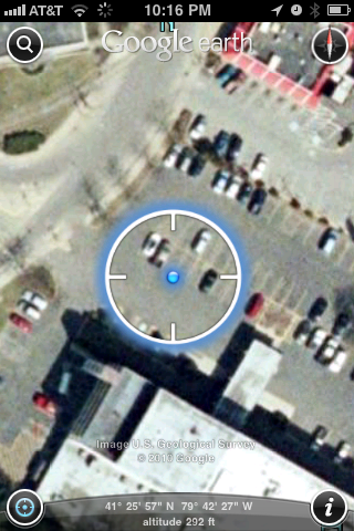
The first thing we did was test the GPS signal in the hotel parking lot and according to the blue dot in the center, it looks to be within a few feet of where we were standing. In the field, the wells are spaced close together, at about 300 feet, and we want to know if the GPS can give accurate enough readings to identify the well locations.
As you will see from the data below, the iPhone GPS is able to identify well site locations in the oil filed. The use of the built-in iPhone GPS would be considered an advanced feature of the wellsite data collection software, however it was an easy thing to test to see if it would work to uniquely identify closely spaced wells, such as the ones in western Pennsylvania.
The use of the GPS feature of the iPhone has some interesting possibilities. It would be able to automatically identify the well as the operator approached the site avoiding the necessity of the operator to manually identify the well, thus reducing the amount of data entry the operator has to perform.
GPS in the Field
We visited four wells and a tank battery. GPS locations were taken at each location, and an additional reading was taken at a nearby gas station for reference. The chart below lists the latitude and longitude for each location and also shows the computation of the distance between each adjacent location.
| location # | Latitude N | Longitude W | Altitude | distance ft | height adj ft | |||
| 1 | 41.424088 | 79.769318 | 1324 | 400.8 | 400.8 | |||
| 2 | 41.425179 | 79.769448 | 1323 | 350.3 | 356.7 | |||
| 3 | 41.426135 | 79.769538 | 1390 | 260.9 | 265.0 | |||
| 4 | 41.426848 | 79.769481 | 1436 | 2540.4 | 2568.2 | |||
| 5 | 41.419896 | 79.769081 | 1059 | 3359.5 | 3511.8 | |||
| 6 | 41.417357 | 79.777933 | 36 | |||||
| Earth Radius | meters/feet | |||||||
| km | 6,371,009.00 | |||||||
| statute miles | 20,902,258.08 | |||||||
| Distances are computed between 1 & 2, 2 & 3, 3 & 4, 4 & 5 and 5 & 6. | ||||||||
| Adjustment for height is calculated from a^2 + b^2 = c^2 where a is the altitude (height) difference and b is the lat-lon distance from the previous column. |
||||||||
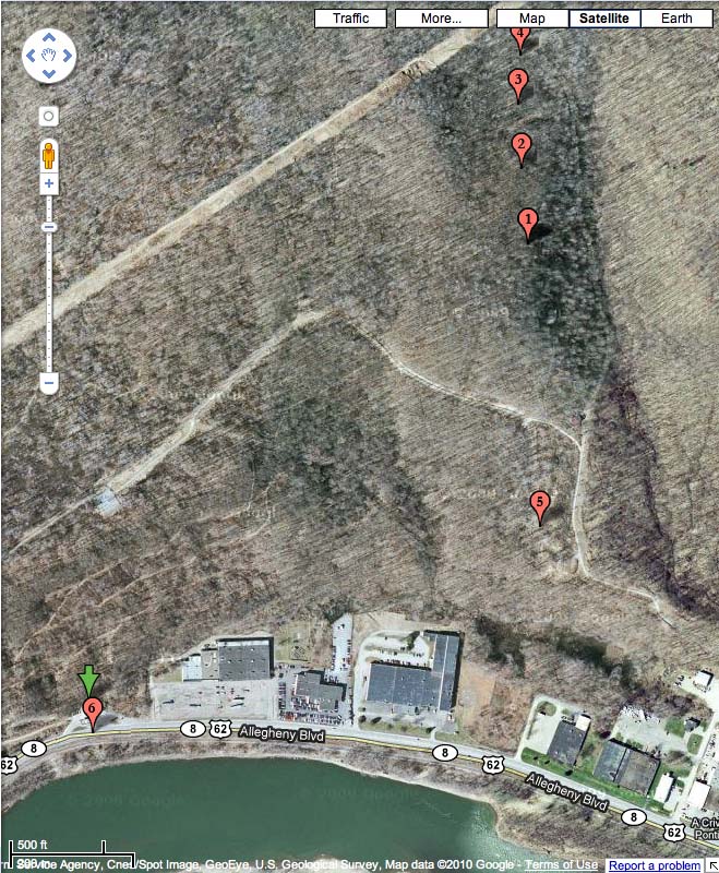
The latitude and longitude readings were then plotted on a Google map as shown below. The locations and distances all correlate with the locations in the field and show that the iPhone GPS functionality is adequate to uniquely locate wells and tank batteries in the oil field, even spaced as closely as the ones in our test field.
Unfortunately, the Google map is not current enough to show the access roads or tank batteries since this is a fairly new oil field. In this case it is unlikely that the wells could be visually spotted on the map because of the tree cover.
We were able to identify the straight line across the upper left portion of the map as the power company right of way. The gas station was also easy to identify on the map.
GPS on the iPhone
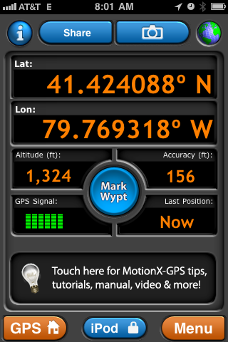
For the test, I used an iPhone application called MotionX GPS. Some of the test screens are shown below. The MotionX GPS application uses the iPhone GPS hardware and wireless communication to gather the GPS data and plot the location on a Google map. It also can use the iPhone camera to record images for a location.
The first screen shot shows the display of latitude and longitude information. You will also notice that the altitude is also given. The is location 1 on the above chart and map.
–
–
–
–
–
–
–
–
–
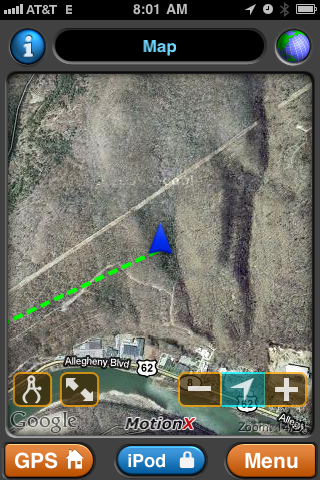
The next screen shot shows the location plotted on a Google Map. It is at a different scale that the map above, but you can still see that the point is in the same location. The map is retrieved over wireless communication, however maps can be preloaded for locations where there is poor signal strength.
–
–
–
–
–
–
–
–
–
–
–
–
–
–
–
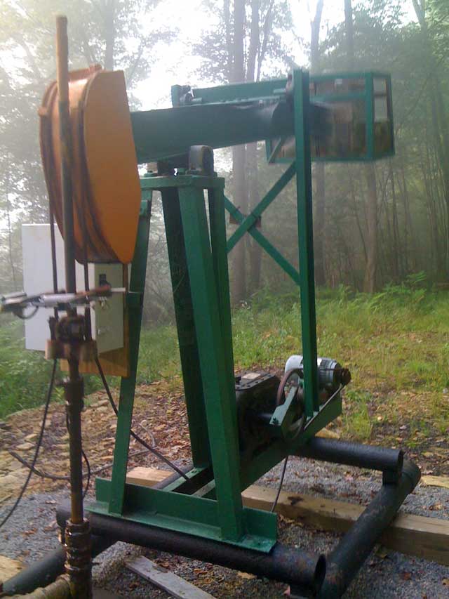
The next image was taken at location 1. It is possible to attach a visual record to each wellsite. The use of the iPhone camera capability could come in handy for a variety of reasons. In addition to visually identifying the well, images can be emailed, perhaps with a picture of a part needing repair at that location.

Recent Comments